We have implemented and tested opensource software toolbox for remote sensing data gapfilling
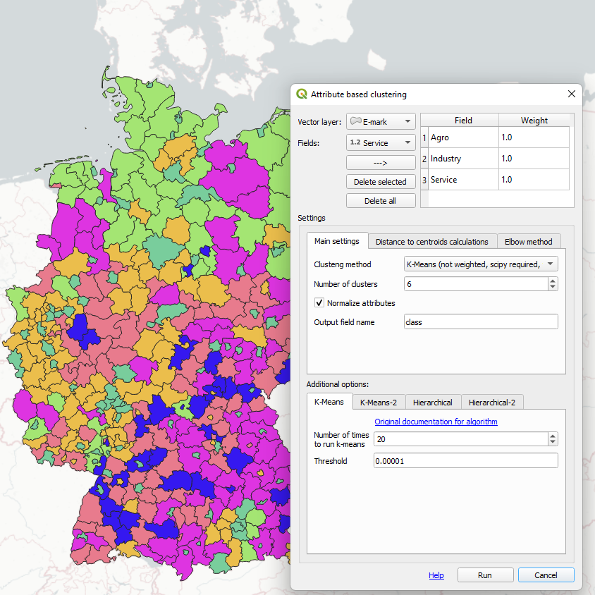
Public QGIS plugins
Several popular plugins in QGIS standard repository
QGIS
python
open-source
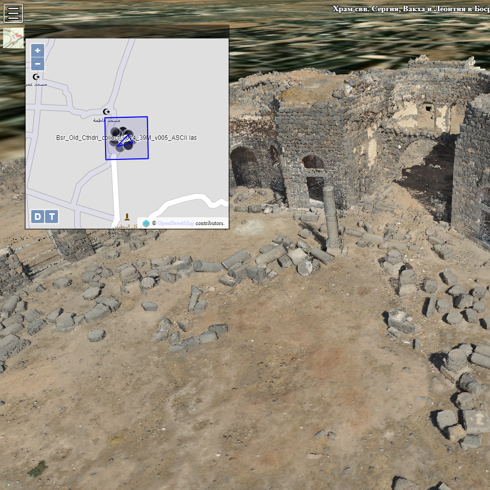
3D GIS of Early Christian Churches in Syria
GIS for historians with 3D models derived by photogrammetric surveying in Syria
3D GIS
Photogrammetry
JavaScript
Potree
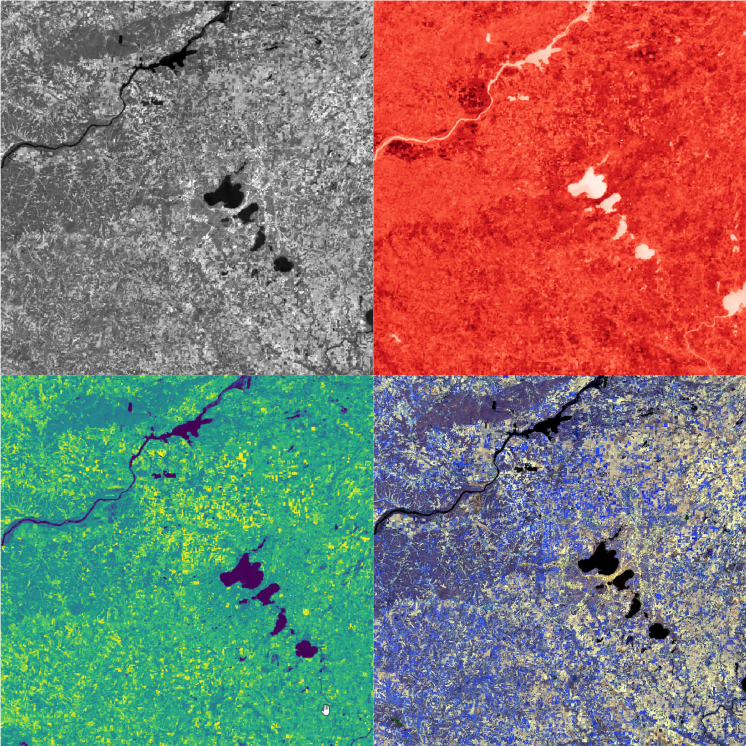
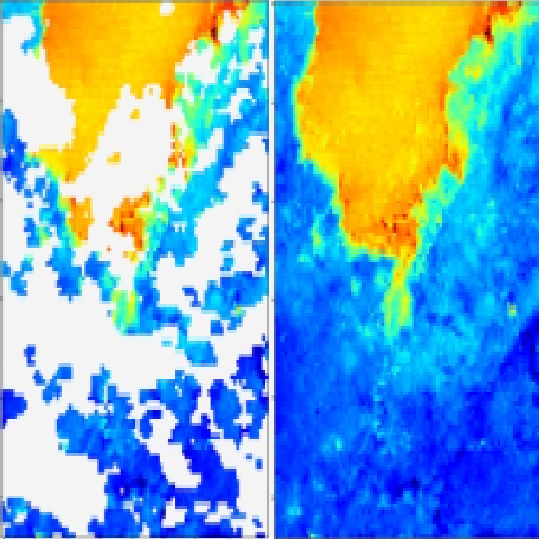
Set of open-source tools for advanced automated Landsat imagery processing
I prepared set of python-classes for advanced Landsat processing
Remote sensing
Python
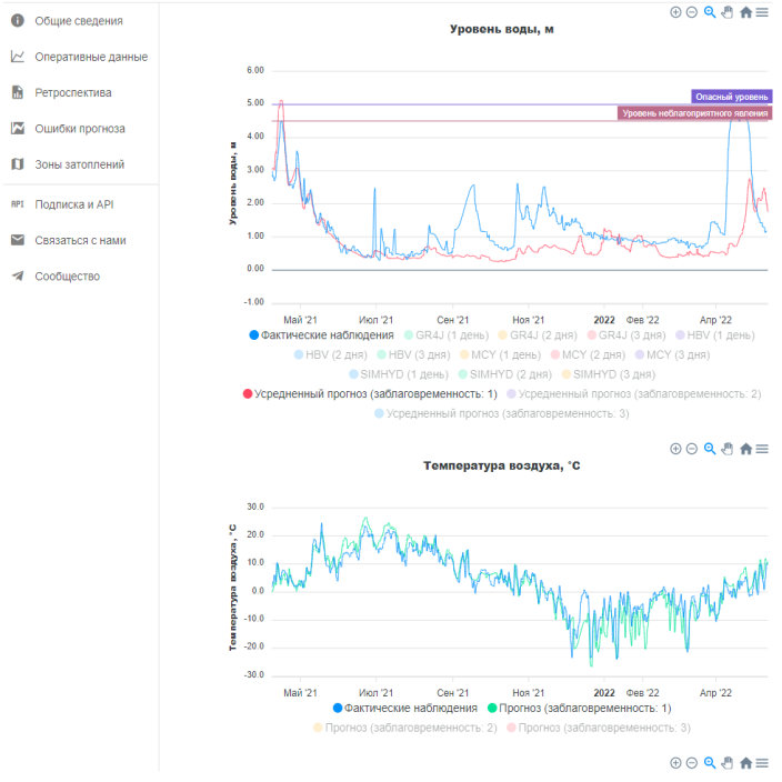
Automated short-term hydrological forecast system
While working in State Hydrological Institute I developed automated system for water levels and discharges forecast at small rivers of North-West Russia.
Environmental monitoring
Hydrological models
Python
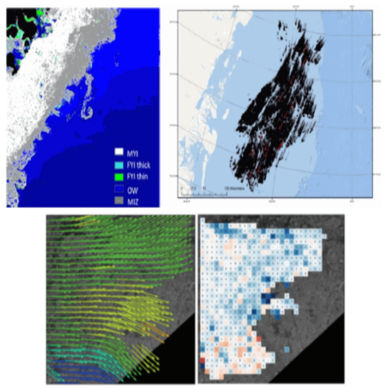
Automated monitoring system of sea ice
We have developed several algorithms of automated sea ice conditions monitoring and unite them to operational informational system
Remote sensing
Machine learning
Python
Environmental monitoring
Computer vision
How coccolithophores affects global climate?
Big science project about specific plankton species influence on global climate
Remote sensing
Spatial analysis
Mapping
Scientific Research
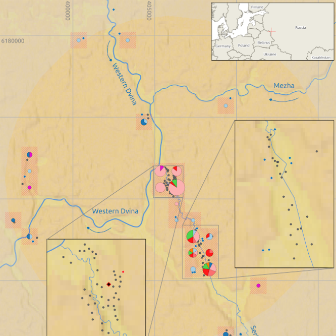
GIS support for archaeological research in the North-West of Russia
Long-term cooperation with Russian, Polish and French researchers of Neolithic sites in the North-West of Russia
Cartography
GIS Analysis
Archaeology